Our treasurer and financial administrator, Virginia Gabert, wrote this summary of the Commission’s role and working methods. Find the forms referenced in her guidelines on the state’s website.
Every city and town in the Commonwealth of Massachusetts has a Conservation Commission. Hawley’s Conservation Commission consists of Lloyd Crawford, chair; Will Cosby; Ashley Harrison; Jerry McCarthy; and Bob Taylor. If you have questions about the commission, you may email it here.
Since Colonial times, almost one third of Massachusetts wetlands have been destroyed. Today, wetlands are protected by state and federal laws. Each town has a Conservation Commission that works hand-in-hand with state agencies to make sure that our water resources remain intact for the future generations.
The role of the Hawley Conservation Commission is to protect the water resources in Hawley by ensuring compliance with the state’s Wetlands Protection Act (MGL Chapter 131, section 40). Water resources serve as environmental, recreational and scenic assets and provide habitat for wildlife.
The primary purpose of the Wetlands Protection Act (WPA) is to protect wetlands and the public interests they serve. These interests include: flood control; prevention of pollution and storm damage; protection of public and private water supplies, groundwater supply, fisheries, land containing shellfish and wildlife habitat. Local Conservation Commissions protect these areas by requiring review of all proposed work that may alter these water resource areas.
These water resource areas are also referred to as “resource areas” and include:
- Bordering Vegetated Wetlands (BVW)
- Land subject to flooding
- Riverfront areas (also protected through the Rivers Protection Act)
- Land under water bodies
- Banks of water bodies
The way the Wetlands Protection Act protects these various water resources is by creating “jurisdictional areas” comprised of the resource areas as well as certain buffer zones near these resource areas. Under the act, no one may “remove, fill, dredge, or alter” any wetland, bank of a lake or stream, land under a water body, land within 100 feet of any of these resource areas, land within 200 feet of a perennial stream or river, or within a floodplain regardless of ownership without a permit from the Conservation Commission. The term ‘alter’ includes any activities that will change drainage characteristics; impact the water table; destroy vegetation; or impact the physical, biological, or chemical characteristics of any other body of water or resource area nearby.
The regulations prohibit most destruction of wetlands and naturally vegetated riverfront lands. Wetlands are defined by the type of vegetation, hydrology, and soils, and it may take a qualified specialist to determine their boundaries. Certain resource areas are not easy to determine without some training or expertise.
You may have an intermittent stream that is not running at the time you are looking at it, or certain wetland soils that you can’t identify without soil or plant sampling. And work that you want to do may be near a resource area that is not on your property and that you may not even see. The safest thing to do is to either check with the Conservation Commission prior to doing any work, or hire a qualified wetlands professional to look at your site and help you identify and determine the wetlands boundaries and areas under the jurisdiction of applicable laws (there are several qualified wetlands professionals in our geographic area). Moving forward on work in jurisdictional areas without a permit may result in an enforcement order from the Conservation Commission, and added time, expense, and delay for your project.
If you are considering doing any work on land on or near the above resource areas, you may need to obtain a permit from the Conservation Commission. The Commission issues these permits on behalf of, and with the assistance of, the Department of Environmental Protection (DEP).
A permit may be required if you are doing any construction, digging, cutting of trees, or other work:
- Within 200 feet of a perennial stream.
- Within 100 feet of an intermittent stream.
- Within 100 feet of a wetland,
- Within 100 feet of a lake or pond
- Within a 100 year floodplain,
Some minor activities may be exempt from these permitting requirements. You may contact the Commission to ask if your planned activities are exempt, or consult the regulations (310 CMR 10.00 – available on the internet).
If your planned activities require Conservation Commission review, you will first fill out an application to obtain approval for your project (Notice of Intent), or for a determination of whether or not the WPA applies to your project (Determination of Applicability). The purpose of the application is to provide the Commission and the Department of Environmental Protection with a complete and accurate picture of the site, the work that you want to do on it, and how the work will be done. After receiving a complete application, the Conservation Commission will hold a public hearing, where it will make a ruling on your application. If work is started without a permit, or if an Order of Conditions is not followed, an Enforcement Order may be issued, causing you to stop work until the situation is fixed. Enforcement Orders issued by the Conservation Commission are also filed with the Department of Environmental Protection (DEP). In addition, the Conservation Commission can refer the case to the DEP, who can assess fines depending upon the extent and the type of the violation.
This section will explain how evaluation and permitting is done by the Conservation Commission.
A permit may be required if you are considering doing any construction, digging, cutting of trees, or other work:
- Within 200 feet of a perennial stream (generally running through the year).
- Within 100 feet of an intermittent stream (generally running, but not year-round).
- Within 100 feet of a wetland,
- Within 100 feet of a lake or pond
- Within a 100 year floodplain,
The difference between perennial and intermittent streams is determined by referring to USGS quad maps–to which the Commission has access, and which are accessible online on the DEP website. Some minor activities may be exempt from these permitting requirements (examples are listed below). The land within the areas listed above is always subject to the regulations; it is the activities that may be exempt. When in doubt, it is best to ask.
Determination of Applicability
If you are not sure whether an area is subject to jurisdiction, or if the activity may not result in the alteration of a resource area, you should file Form 1 – Request for Determination. This Request asks one or more of the following questions: whether the area is subject to jurisdiction, whether the boundaries of the resource areas are correct, whether the proposed work is subject to jurisdiction, or whether the area/work is subject to a wetlands bylaw. After this Request is filed with the Commission, the Commission will schedule a site visit, and a public meeting. There is no fee associated with the Application itself, but the applicant will be required to pay for the required newspaper advertisement for the public meeting. If the Commission has enough information to make a determination, it will issue a Form 2 – Determination of Applicability. A negative determination is issued if the area is not subject to jurisdiction, or if the activity will not alter a resource area. A positive determination either confirms the wetland boundaries (if no work is proposed), or confirms that the work is subject to the Wetlands Protection Act, and a Notice of Intent will be required before the activity can start.
Notice of Intent
If the proposed activity is in an area subject to jurisdiction, you should file Form 3 or 4 – Notice of Intent (or Abbreviated Notice of Intent). This process will take one month to several months. How long it takes depends on the complexity of the project, DEP review and issuance of file number, and the schedule of the Commission. In addition to the completed Notice of Intent, you will be required to also provide a set of plans (1”=50’ is standard); 8 ½” x 11” section of USGS topo map of the subject area; the correct filing fee; landowners permission and signature (if the landowner is not the applicant); proof of mailing to NHESP (if applicable); proof of abutter notification; and possibly proof of other permits (if applicable); and professional assessment (as needed).
Order of Conditions
The Commission will issue an Order of Conditions in response to a Notice of Intent. This will either permit or deny the proposed activities; establish required conditions for the proposed work; ensure that performance standards are met; and resource area impacts are minimized. A project can be denied if it does not meet the performance standards or for lack of information. The Order of Conditions must be recorded at the Registry of Deeds, at the applicant’s or landowner’s expense.
Appeals
Once an Order of Conditions (a permit) is issued, there is a 10-business-day appeal period. The decision can be appealed by the applicant, landowner, abutter, aggrieved party, 10 local citizens, or DEP.
Monitoring and Compliance
The Commission may require a pre-construction meeting; perform compliance inspections; and will make a final site visit before issuing a Certificate of Compliance. The Certificate of Compliance is requested by the applicant after the work has been completed. The Certificate is either issued or denied by the Commission (or DEP, if they issued a superseding Order of Conditions), and indicates that the work has been completed in compliance with an Order of conditions. It may also contain conditions, such as for ongoing maintenance or monitoring.
Enforcement Orders
If the Commission discovers a violation of the Wetlands Protection Act, a single Commissioner may issue an Enforcement Order, which will be ratified by a majority of the Commission members at the next scheduled meeting. A copy of the Enforcement Order is filed with DEP. Also, if DEP discovers a violation, they may notify the Conservation Commission to take action, or they may take action independently.
Other agencies involved
NHESP – National Heritage Endangered Species Program
Oversees protection of habitat for endangered plants and animal species under the Massachusetts Endangered Species Act (MESA).
USACE – US Army Corps of Engineers
Oversees structural activities in waterways of the US.
EPA – Environmental Protection Agency
Oversees protection of wetlands other than floodplains or riverfront area.
Exempt activities include
- Unpaved pedestrian walkways for private use;
- Fencing, stonewalls, stacks of firewood – as long as they do not act as a barrier to wildlife movement;
- Vista pruning (must be certain distances from riverfront or BVW);
- Planting of native tree species;
- Conversion of impervious surfaces to vegetated surfaces;
- Activities that are temporary in nature; and have negligible impacts.
The Commission has printed copies of Landscapers and the Massachusetts Wetlands Protection Act, which are available at the Town Office. This is a good resource for basic information on the parameters of the Act, and responsibilities of the Commission.
For more information, ask one of the Commissioners, or consult the regulations (310 CMR 10.00 – 10.99) available on the internet.
Forms are available online at www.mass.gov/dep under “Water Resources,” Wetlands & Watersheds,” “Wetlands Protection,” “Permits & Forms, “Wetlands and Waterways Forms,” and finally “Wetlands Protection Act Permits.”
As explained above, the Conservation Commission helps oversee several wetland resource areas. These areas include:
- Bordering Vegetated Wetlands
- Land subject to flooding
- Riverfront areas (also protected through the Rivers Protection Act)
- Land under water bodies and waterways
- Banks of water bodies
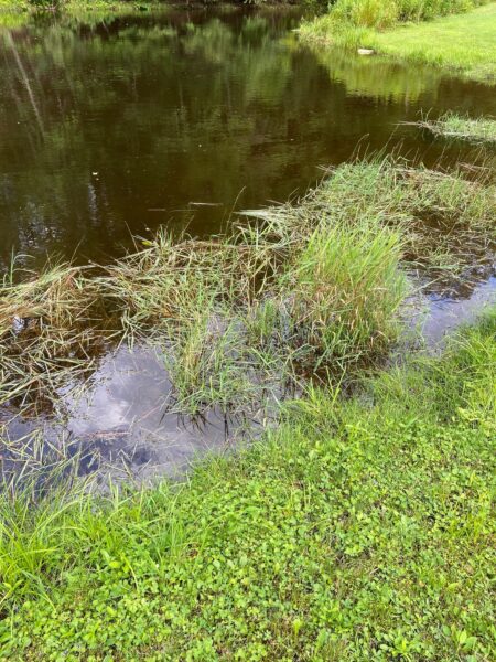
Bordering Vegetated Wetlands (“BVW”)
The plants and soils of Bordering Vegetated Wetlands remove or detain sediments, nutrients (such as nitrogen and phosphorous) and toxic substances (such as heavy metal compounds) that are present in run-off and flood waters. Some nutrients and toxic substances are detained for years in plant root systems or in the soils. Others are held by plants during the growing season and released as the plants decay in the fall and winter. This latter phenomenon delays the impacts of nutrients and toxins until the cold weather period, when such impacts are less likely to reduce water quality.
BVW are areas where ground water rises to the surface and where, under some circumstances, surface water sinks into the ground water. The profusion of vegetation in BVW acts to slow down and reduce the passage of flood waters during periods of peak flows by providing temporary flood water storage and by facilitating water removal through evaporation and transpiration. This process reduces downstream flood crests and resulting damage to private and public property. During dry periods the water retained in BVW is essential to the maintenance of normal water levels in rivers and streams, which in turn is important to the protection of water quality and water supplies.
Land Subject to Flooding (Floodplain)
Wildlife depend on the distribution of water over time, plant community composition and structure, topography, soil composition and proximity to water bodies and BVW of these portions of floodplains for important food, shelter, and breeding areas. Nutrients from flood waters, as well as the inundation of floodplain soil, create important wildlife habitat characteristics, such as richness and diversity of soil and vegetation. A great many species require or prefer habitat which is as close as possible to water and/or has moist conditions, characteristics generally present on lower floodplains. Similarly, lower floodplains, because of their proximity to water and vegetated wetlands, can provide important shelter for wildlife which needs to migrate between such areas, or between such areas and uplands. The “edge” where floodplain habitat borders vegetated wetlands or water bodies is frequently very high in wildlife richness and diversity. Similar “edges” may be found elsewhere in the lower floodplain, where differences in topography and frequency of flooding have created varied soil and plant community composition and structure.
Finally, vernal pool habitat is found at various locations throughout the 100 year floodplain, the pool itself generally formed by meander scars, or sloughs left after the main water channel has changed course. These pools are essential breeding sites for certain amphibians which require isolated areas that are generally flooded for at least two continuous months in the spring and/or summer and are free from fish predators. Most of these amphibians remain near the breeding pool during the remainder of their lifecycle. Many reptiles, birds and mammals also feed here.
Riverfront Areas
The Riverfront area includes land up to 200’ from a river or perennial stream.
The presence of natural vegetation within riverfront areas is critical to sustaining rivers as ecosystems and providing the following public values. The riverfront area can prevent degradation of water quality by filtering sediments, toxic substances (such as heavy metals), and nutrients (such as phosphorus and nitrogen) from storm water, nonpoint pollution sources, and the river itself. Sediments are trapped by vegetation before reaching the river. Nutrients and toxic substances may be detained in plant root systems or broken down by soil bacteria. Riverfront areas can trap and remove disease-causing bacteria that otherwise would reach rivers and coastal estuaries where they can contaminate shellfish beds and prohibit safe human consumption. Natural vegetation within the riverfront area also maintains water quality for fish and wildlife.
Land Under Waterbodies and Waterways (LUWW)
The physical nature of LUWW is highly variable, ranging from deep organic and fine sedimentary deposits to rocks and bedrock. The organic soils and sediments play an important role in the process of detaining and removing dissolved and particulate nutrients (such as nitrogen and phosphorous) from the surface water above. They also serve as traps for toxic substances (such as heavy metal compounds).
The plant community composition and structure, hydrologic regime, topography, soil composition and water quality of LUWW provide important food, shelter, migratory and overwintering areas, and breeding areas for wildlife. Certain submerged, rooted vegetation is eaten by water fowl and some mammals. Some amphibians (as well as some invertebrate species eaten by vertebrate wildlife) attach their eggs to such vegetation. Some aquatic vegetation protruding out of the water is also used for nesting, and many species use dead vegetation resting on land under water but protruding above the surface for feeding and basking. Soil composition is also important for hibernation and for animals which begin to burrow their tunnels under water. Hydrologic regime, topography, and water quality not only affect vegetation, but also determine which species feed in an area.
Banks of Waterbodies (“Banks”)
Where Banks are partially or totally vegetated, the vegetation serves to maintain the Banks’ stability, which in turn protects water quality by reducing erosion and siltation. Banks may also provide shade that moderates water temperatures, as well as providing breeding habitat, escape cover and food, all of which are significant to the protection of fisheries. Banks which drop off quickly or overhang the water’s edge often contain numerous undercuts which are favorite hiding spots for important game species such as largemouth bass (micropterus salmoides).
The topography, plant community composition and structure, and soil structure of banks together provide important food, shelter, and breeding areas for wildlife. Topography plays a role in determining the suitability of banks to serve as burrowing or feeding habitat. Soil structure also plays a role in determining the suitability for burrowing, hibernation and other cover. Bank topography and soil structure impact the bank’s vegetative structure, as well. Bushes and other undergrowth, trees, vegetation extending from the bank into the water, and vegetation growing along the water’s edge are also important to a wide variety of wildlife. A number of tubers and berry bushes also grow in banks and serve as important food for wildlife. Finally, banks may provide impomailto:ConservationCommission@townofHawley.comrtant shelter for wildlife which needs to move between wetland areas.